
AERIAL IMAGING AND SURVEYING - Reno/Tahoe area
Construction, INSPECTIONS, Environmental, AND Agricultural
Please note - I am not a licensed surveyor. The data provided, while meeting survey quality, is intended only for planning & evaluation.
It is the responsibility of the consumer to understand when a board-licensed surveyor is required.
CONSTRUCTION AERIAL PHOTOGRAPHY
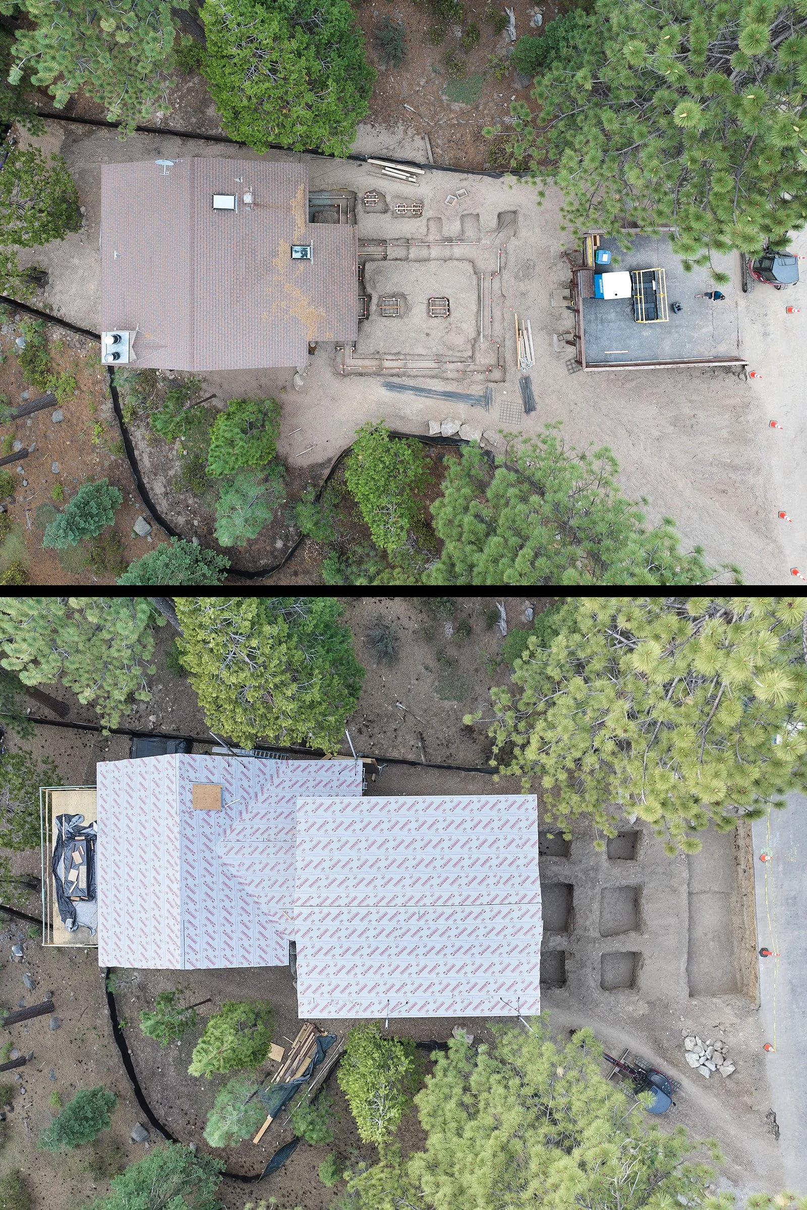
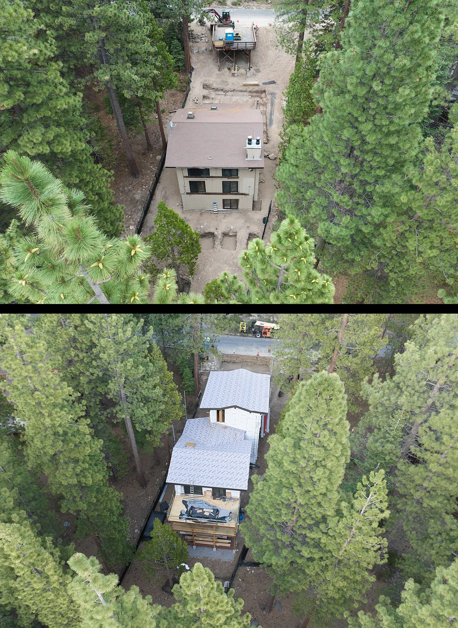
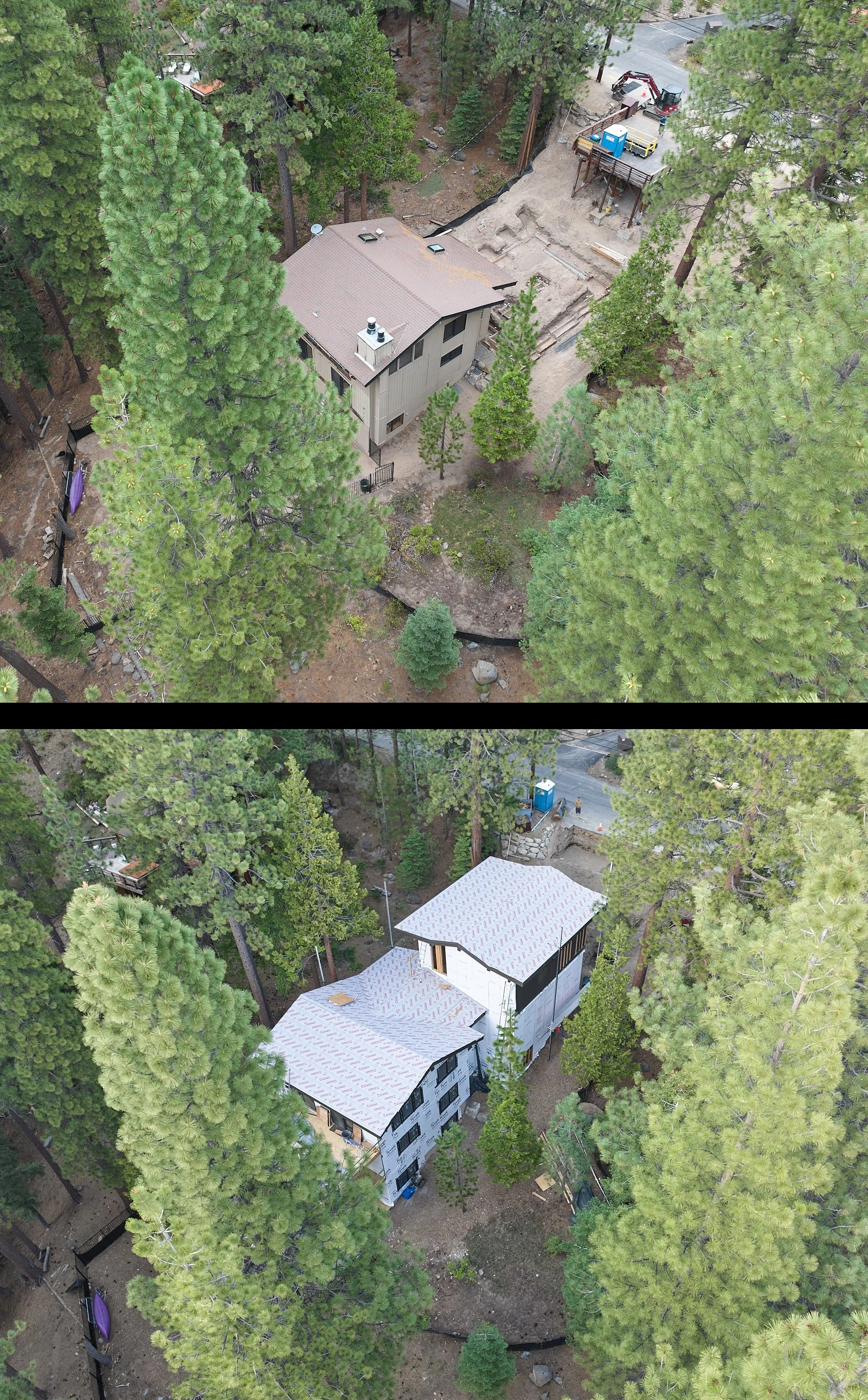
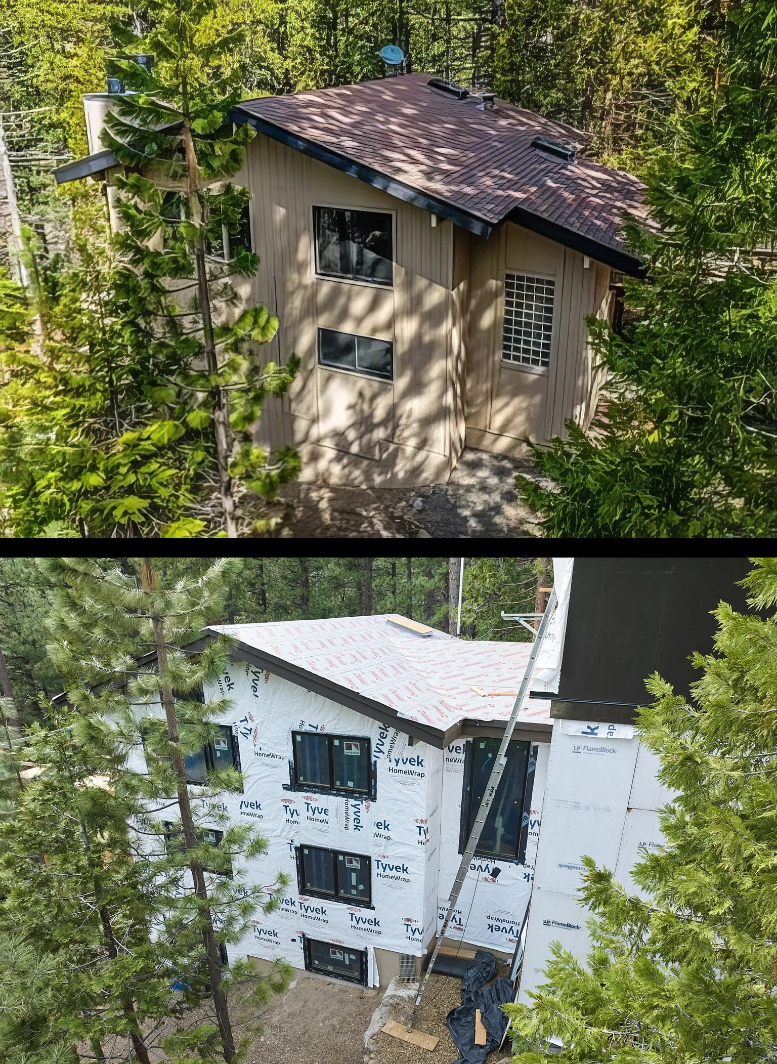
Aerial photography of construction sites can help you plan, assess progress, keep stakeholders informed, and make better decisions. High-resolution photos and 3D modeling available. Serving Reno, Tahoe, Carson City, and surrounding areas.
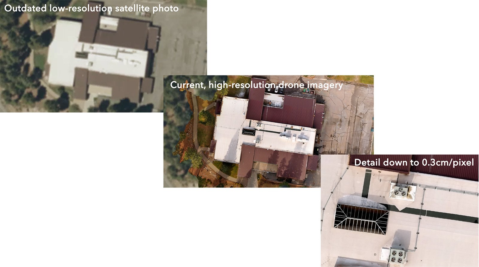
I provide aerial photography of large-scale sites in the Reno, Carson City, and Lake Tahoe areas. Products include visible imaging, thermal imaging, digital surface models, and 3D imaging. Assess conservation efforts, health, and plan for the future.
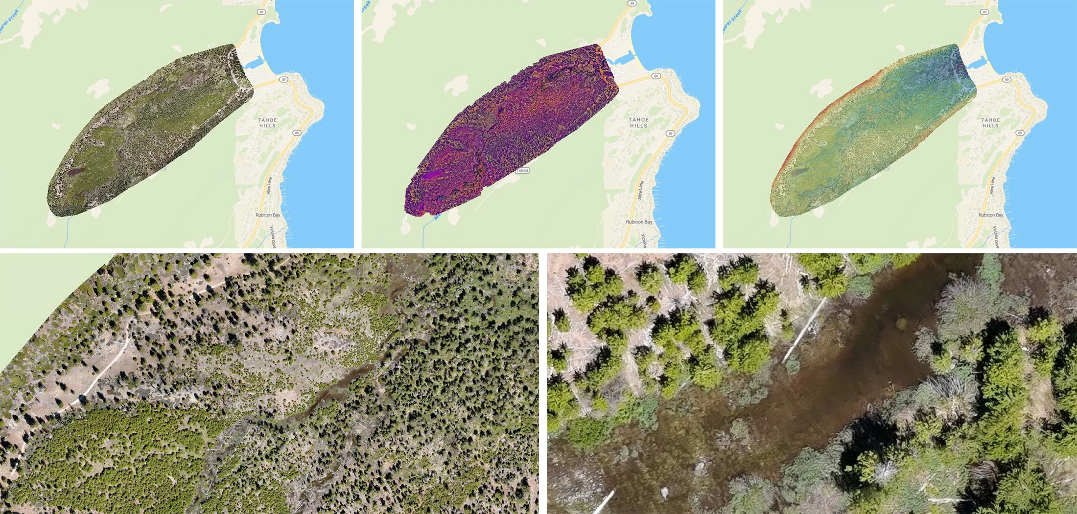
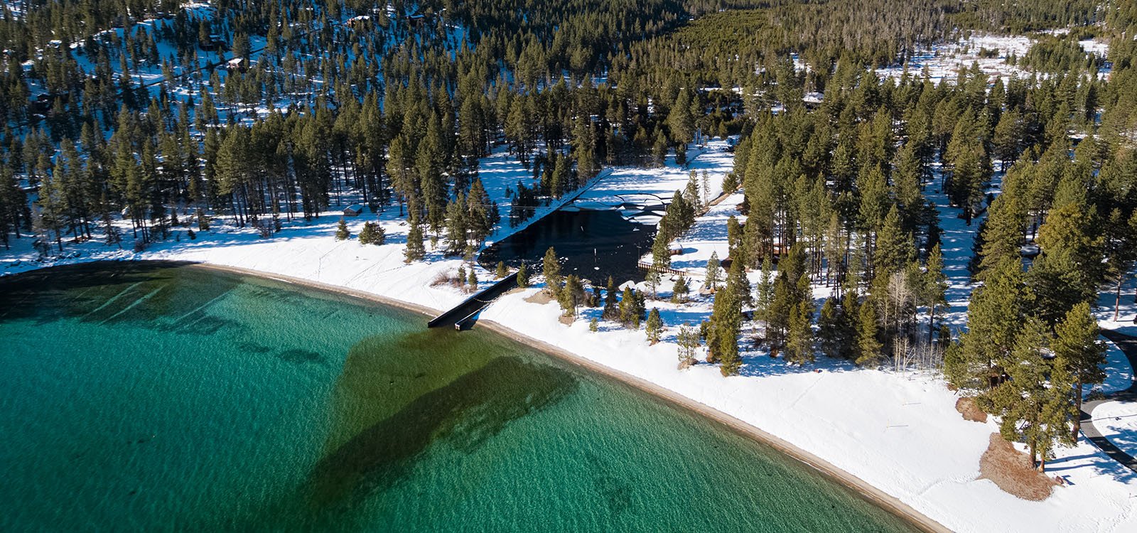
AGRICULTURAL & ENVIRONMENTAL AERIAL IMAGING
About Your Pilot…
I started flying in 1998 and, over the years, have flown 14 different manned aircraft, from the Cessna 152 to the F-15E, logging over 2,000 hours, including 114 combat missions over Afghanistan.
I’ve been an FAA-licensed drone pilot since 2017 and have also flown several different types of drones in different capacities. In addition to augmenting my photodocumentaries, I also helped local Search and Rescue teams stand up their drone programs. I am currently a sUAS (drone) Instructor Pilot for the Civil Air Patrol Nevada Wing.

GET A QUOTE
Could you benefit from aerial imaging & mapping services in the Reno, Carson City, or Lake Tahoe area?
Please provide as much detail as possible for an initial estimate, including:
Location of the project
Site or project size
Products needed (2D photomosaics, 3D models, point clouds, thermal imaging, video flythroughs, etc)
Resolution required (do you need to see in centimeters, inches, or feet?)
File types required/software used
Date(s) to be flown or when data is required
Special property limitations, if any